Regional Historical Context for Planners

LA Metro recognizes that we occupy land originally and still inhabited and cared for by the Tongva, Tataviam, Serrano, Kizh and Chumash Peoples. We honor and pay respect to their elders and descendants—past, present and emerging—as they continue their stewardship of these lands and waters. We acknowledge that settler colonization resulted in land seizure, disease, subjugation, slavery, relocation, broken promises, genocide and multigenerational trauma. This acknowledgment demonstrates our responsibility and commitment to truth, healing and reconciliation and to elevating the stories, culture and community of the original inhabitants of Los Angeles County. We are grateful to have the opportunity to live and work on these ancestral lands. (Read more: Los Angeles City/County Native American Indian Commission.)

Los Angeles at a Glance

Established in 1850, Los Angeles County is one of California’s original 27 counties.

It is the most populous county in the United States, including 88 incorporated cities and additional unincorporated areas with nearly 10 million residents. The City of Los Angeles is the county’s seat, the second-most populous city in the country and the most populous city in California. Los Angeles County is also home to over a quarter of the state’s residents and is one of the most culturally rich counties in the U.S. with over 185 languages spoken. It is diverse not only linguistically, but also demographically, socially and economically.

LA County is famous for its freeways. While the region is notoriously car-dependent, with traffic conditions often synonymous with its name, public transit has served LA County and its residents since 1873.

For over 150 years, more than 220 private and public companies have operated different transit systems. These systems have evolved from horse carts, cable cars, incline railways, steam trains, electric streetcars, electric interurban trams, trolley buses to gas- or diesel-powered buses. Today, Metro is one of the largest transit agencies in the country and serves many key roles across LA County, acting as transportation planner and coordinator, designer, builder and operator for the country’s largest, most populous county. Metro additionally leads the most extensive infrastructure program in the U.S., which includes bus and rail projects, walking and biking improvements and local highway and freeway projects designed to eliminate long-standing bottlenecks.

Jump to Decade:

Metro operates:

Bus Routes with 12,016 stops
0
Rail Lines with 107 stations spanning 109 miles
0

Metro’s current systems, operations and programming are born from LA County’s rich transportation history. The timeline below outlines how we got here.

Timeline: Transit, Land Use and Equity in LA County

Pre – 1900s

The foundation for public transportation and racially restrictive zoning is established across LA County.

1873
September 22

with the opening of the Pioneer Omnibus Street Line. The line featured horse-drawn vehicles resembling miniature railroad cars on large, wooden wheels. It followed a regular schedule and a fixed route between today's Olvera Street and Washington Gardens.

1874
Spring and Sixth Street Railroad horse-drawn cars become the first streetcars to serve Los Angeles

Fare was ten-cents, and passengers could ride the one-and-a-half-mile route from Temple and Spring south to Sixth, and then west to Figueroa.

1875
The Pioneer Omnibus Street Line shuts down due to poor street maintenance
1876
East LA and Boyle Heights become LA’s first “streetcar suburbs”

Spring & Sixth service reached East LA in 1876 - the Los Angeles and Aliso Avenue Street Passenger Railway arrived in Boyle Heights following year. This railway service made relocation from smaller towns to the central city area more practical for County residents.

1885
Metro-Equity-Toolkit-history-timeline-second-street-cable-railway

Site of Second Street Cable Railway, July 1885

The first railway system in LA commences service through Bunker Hill, the Second Street Cable Railway offered connections to LA’s western area.
1892

Lee Sing sues the City of Ventura for trying to restrict people of Chinese origin from residing within the city’s jurisdiction.

Federal courts ruled in favor of Mr. Sing, deciding state and municipal governments could not discriminate. The ruling, however, maintained that individuals could discriminate when entering into residential contracts, laying the groundwork for racially restrictive land covenants. These covenants were used as a legal tool to restrict people solely based on their race, religion or national origin in LA and the state of California.

Spotlight

Definition – Racially Restrictive Land Covenants

Contracts placed in home deeds by white property owners and/or developers that barred purchasers from selling or renting to ethnic or religious minorities.

This language is still present in housing records and agreements passed onto new property buyers.

In 2021, California enacted a law that requires counties to identify and redact deed records that include these covenants.

1895

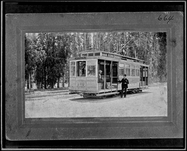
Los Angeles Railway Company (LARy) begins operation. LARy, also known as the Yellow Cars, served the City of LA and its immediate surroundings as an urban railway and streetcar system. These routes were largely concentrated in central Los Angeles.

1897
LA’s Last Horse Railway ceases operation

The line replaced the railway with cable car wires.

1898
Metro-Equity-Toolkit_Historical-Context_LARy-1898

Henry E. Huntington, a former Southern Pacific board member and owner of the Pacific Electric Railway Company (PE) purchases LARy and redevelops line system.
1900s and 1910s

LA County highway development is conceptualized.

1902
First racially restrictive land covenant filed

The first racially restrictive land covenant is filed in LA. Covenants barred all non-white residents from purchasing specific pieces of property. These clauses were also added to property deeds, identifying who could or could not own or reside on the property. These clauses were written meticulously and maliciously – a property that had been sold and resold several times could revert to the original deed holder if the covenant was breached.

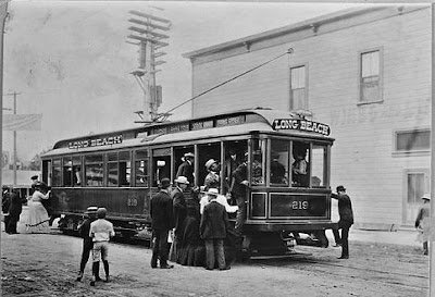
Metro-Equity-Toolkit_Blue-Line

The Blue Line was the first rail between these two cities and represented an oncoming period of rapid public transit growth.
1903
The Los Angeles Realty Board forms

The Los Angeles Realty Board brought together real estate agents into a professional organization with a governing board. It influenced the growth and development of LA’s neighborhoods and communities. The Board initiated a campaign to attach racially restrictive land covenants on as many new developments as possible.

Pacific Electric Traqueros strike after a dispute on the construction of the Main Street streetcar line

PE’s Mexican and Mexican American track workers, "Traqueros," demanded higher wages that matched those of European immigrants working on the same project. Mexican workers were paid less than southern European immigrants, who earned $1.75 a day in contrast to Mexican workers’ $1.25 a day for a ten-hour shift. The strike was organized by the Union Federal Mexicanos, a group representing approximately 700 workers. The strike failed after PE hired replacements from other projects at higher pay rates, and the union failed to persuade other system workers to join. The Traqueros returned to work after five days.

Spotlight

PE Section Camps

Railroaders during the late 1800s and early 1900s, including PE, preferred to hire Mexican and Mexican American workers, in part due to the Chinese Exclusion Act. At the time, they comprised around 60 percent of the industry’s workforce and were critical to both freight and urban rail expansion across the country—including LA County. As PE’s system grew, so did their need for labor. By 1927, the company had invested nearly $200,000 in land, buildings and facilities at 22 section camps that housed Traqueros and their families. A monument is currently being constructed in Venice, in partnership with the City of L.A., to memorialize the resilience and impact of the Traqueros.

Visit this link to hear more about life in PE’s Culver City Section Camp.

For additional information, we recommend:

1909
California passes highway construction bond

Passed under Governor Hiram Johnson, California’s voters approved an $18 million (~$589.5 million in 2025 adjusted for inflation) bond issue for statewide highway system construction.

1911
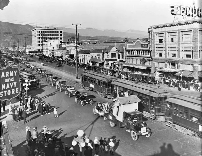
Metro_EJToolkit_Historical-Context_Great-Merger

This merger consolidated several local line operators under PE. During this time, Henry E. Huntington left PE. Thus, interurban rail lines operated under PE and intraurban lines operated under LARy.
1920s

LA’s rail systems are the largest globally as regional bus routes and highway system development expand across the county.

1920s
PE is the largest electric rail system globally
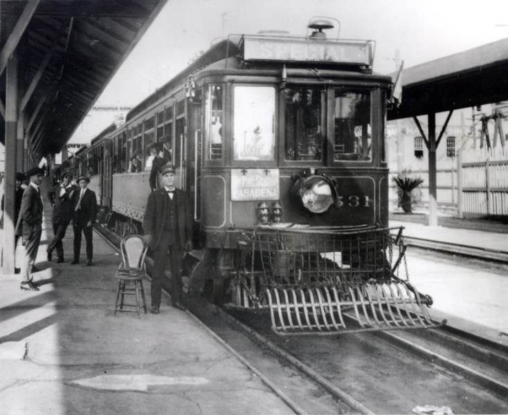
Metro-Equity-Toolkit_Historical-Timeline_PE-Red-Cars_1920

PE, nicknamed the Red Cars, was a privately-owned mass transit system in Southern California consisting of electrically powered streetcars, interurban cars and buses. The system organized itself around the City of LA and regional urban areas, and connected cities in Los Angeles, Orange, San Bernardino and Riverside Counties. Many considered the Pacific Electric System a precursor to the contemporary Southern California Regional Rail Authority’s Metrolink commuter lines.
1922
1923
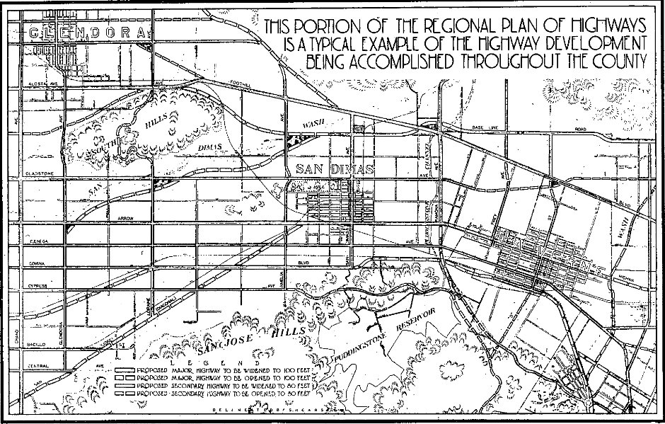
Metro_EJToolkit_Historical-Context_Highway-Planning

The Board stressed the need for a highway network in a formal resolution. This becomes one of the Planning Commission’s major tasks.
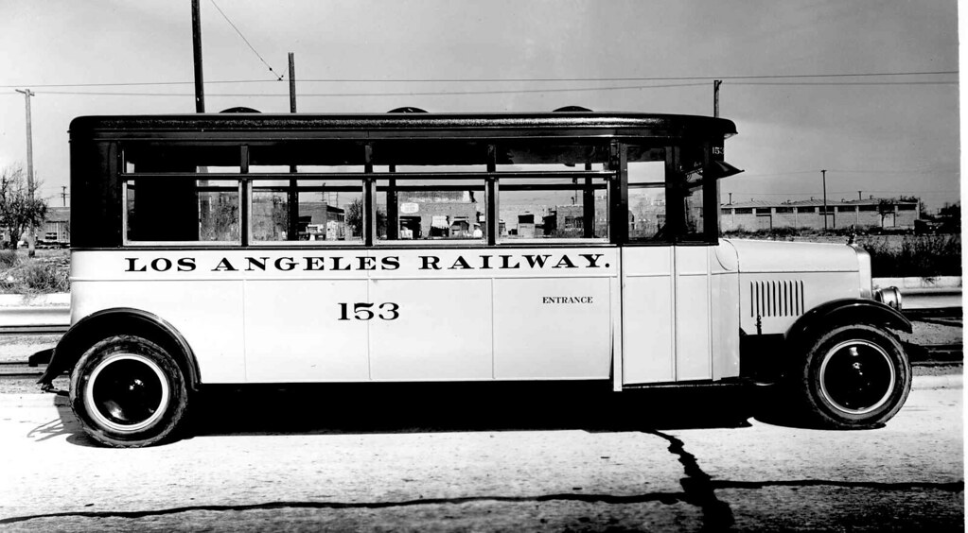
Los Angeles Motor Bus Company service begins

The Company was a collaboration between PE and LARy.

The first state gas tax is created to fund the state highway system’s expansion

Accompanying legislation also created the "Motor Vehicle Fuel Fund," with some of the money going directly to counties and other funds being deposited into the "State Highway Maintenance Fund" for state highway maintenance, repair, widening, resurfacing and reconstruction.

1925
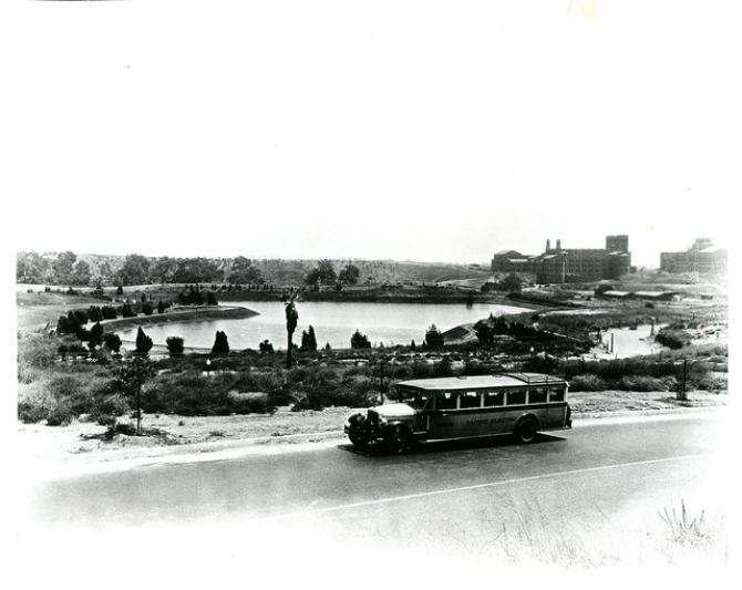
LA Motor Bus Company expands
Metro_EJToolkit_Historical-Context_LARy-Bus_1925

LA Motor Bus Company bus route system expanded to 53 miles.
City Council commissions the Comprehensive Rapid Transit Plan for the City and County of Los Angeles

The Comprehensive Rapid Transit Plan for the City and County of Los Angeles was designed to accommodate the living and business demands for a future city of 3,000,000 people.

This bold and highly influential plan recognized rapid transportation’s fundamental role in LA’s growth and community development. It featured both physical designs and foundational principles for the future of the city and county, including a proposal for separated transit planes such as subways, tunnels and elevated structures that would enable LA to keep up with industry and population growth. The plan also acknowledged the social aspects of transportation, noting how transportation projects could help decisionmakers envision and plan a more prosperous future for the metropolitan center of Southern California. The plan also ushered in a new era of experimentation with alternative fuels.

1930s

The Home Owners’ Loan Corporation develops and implements Redlining across LA County, laying the groundwork for current housing and land use patterns. Rail begins sharing road space with automobiles more frequently, creating and exacerbating congestion across LA County. The County responds by building more roads.

1933
Congress establishes the Home Owners Loan Corporation (HOLC)

As part of the New Deal, the corporation’s purpose was to refinance home mortgages in default to prevent foreclosure, as well as to expand home buying opportunities for Americans in the wake of the Great Depression.

Spotlight
1933 - 1936

Low Interest Mortgages Issued

Between 1933 and 1936, the HOLC issued low-interest mortgages to over a million homeowners who had defaulted or been foreclosed on.

1934

also known as the Better Housing Program, as part of the New Deal to make housing and mortgages more affordable.

The act created the Federal Housing Administration (FHA) and Federal Saving and Loan Insurance Corporation (FSLIC) and was designed to stop bank foreclosures on family homes. These policies had disparate impacts on communities along segregated lines and primarily benefited white families. Black, Indigenous and People of Color (BIPOC) were left out of new suburban communities and instead constrained into urban housing projects. The FHA refused to insure mortgages in and near Black neighborhoods, while simultaneously subsidizing white subdivisions Black Americans could not buy into.

The FHA and FSLIC were foundational to the mortgage and home building industries until the 1980s.

1935

The program gathered neighborhood data from 239 cities that was compiled results into an “A to D” rating system.

Spotlight

HOLC Rating System – The Foundation of Redlining

The HOLC’s rating system was translated into color-coded maps using green for A, blue for B, yellow for C, and red for D. This system coding is the origin of the term redlining.

The HOLC and FHA valued ethnic and racial homogeneity. “Red” communities were usually comprised of minority or immigrant residents. As a result, this system drew investment away from diverse communities and neighborhoods along racial lines.

Redlined Communities:

  • Struggled to receive federally backed home loans, as well as home improvement loans.
  • Became equated with race and class, leading to segregation – white communities often sought to exclude populations perceived as threatening to home values, which were most often BIPOC.
  • Were more likely to be situated near industrial areas, vice districts, and environmentally compromised settings, exposing residents to disproportionate health risks and crime.
1936
The Motor Transit Company acquires PE
Metro_EJToolkit_Historical-Context_PE-Bus

The Motor Transit Company operated intercity bus service within Southern California. This set the stage for the regional transition from rail to bus systems.
1938
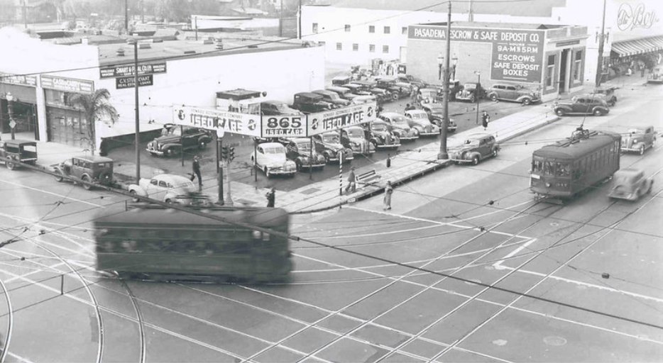
PE starts to reduce its service lines
Metro_EJToolkit_Historical-Context_PE-Rail-1938

LA County expands freeway access onto former PE roadbed.
1939
HOLC publishes redlined map of LA
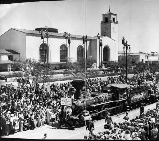
Metro_EJToolkit_Historical-Context_Chinatown-Displaced

Union Station opens, displacing LA’s original Chinatown. Despite nearly two decades of site contestation, LA moved forward with construction of Union Station. Ultimately, the Union Station project destroyed Chinatown and its general stores, community organizations, restaurants, schools and temples.
Spotlight

LA’s Old Chinatown

The 1848 discovery of gold at Sutter’s Mill instigated the California gold rush and prompted immigration from across the globe—including China.

After passing a Foreign Miners’ Tax in 1850, which targeted Mexican miners, California’s legislature passed a similar law in 1852 aimed at Chinese immigrants. This tax levied $3 monthly from Chinese miners. By the time the law was voided in 1870, there were 63,000 Chinese immigrants in the U.S. —77 percent of whom were in California. Chinese miners had paid over $5 million in state taxes, a quarter of the state’s then revenue.

To avoid these taxes, many Chinese immigrants left mining and found work on railroads, in agricultural fields, or as cooks and laundrymen. From 1865-1869, 12,000 Chinese immigrants constructed the western section of the transcontinental railroad—comprising 90 percent of Central Pacific’s workforce.

LA’s Old Chinatown grew during the 1850s and 1860s as railroad companies recruited Chinese immigrants to their workforce. Chinese residents were only permitted to rent in this small area located around Alameda and Macy Streets (now Cesar Chavez Avenue), adjacent to Los Angeles Plaza. Between 1850 to 1900, the Chinese population grew to approximately 3,000 residents and Chinatown became a full-fledged community spread over 15 streets. Between 1852 to 1900, Chinese immigrants were permitted to rent only in this small area.

On October 24, 1871, racial tensions exploded in Chinatown when a white police officer was shot. The neighborhood was ransacked and looted. By night’s end, roughly twenty Chinese residents were dead, most of them hanged. The incident remains one of the worst instances of mass lynching in American history.

For more information, we recommend these resources: National Park Service, PBS, Smithsonian Magazine, U.S. Department of Labor, Segregation by Design and Where You Stand: Chinatown 1880 to 1939.

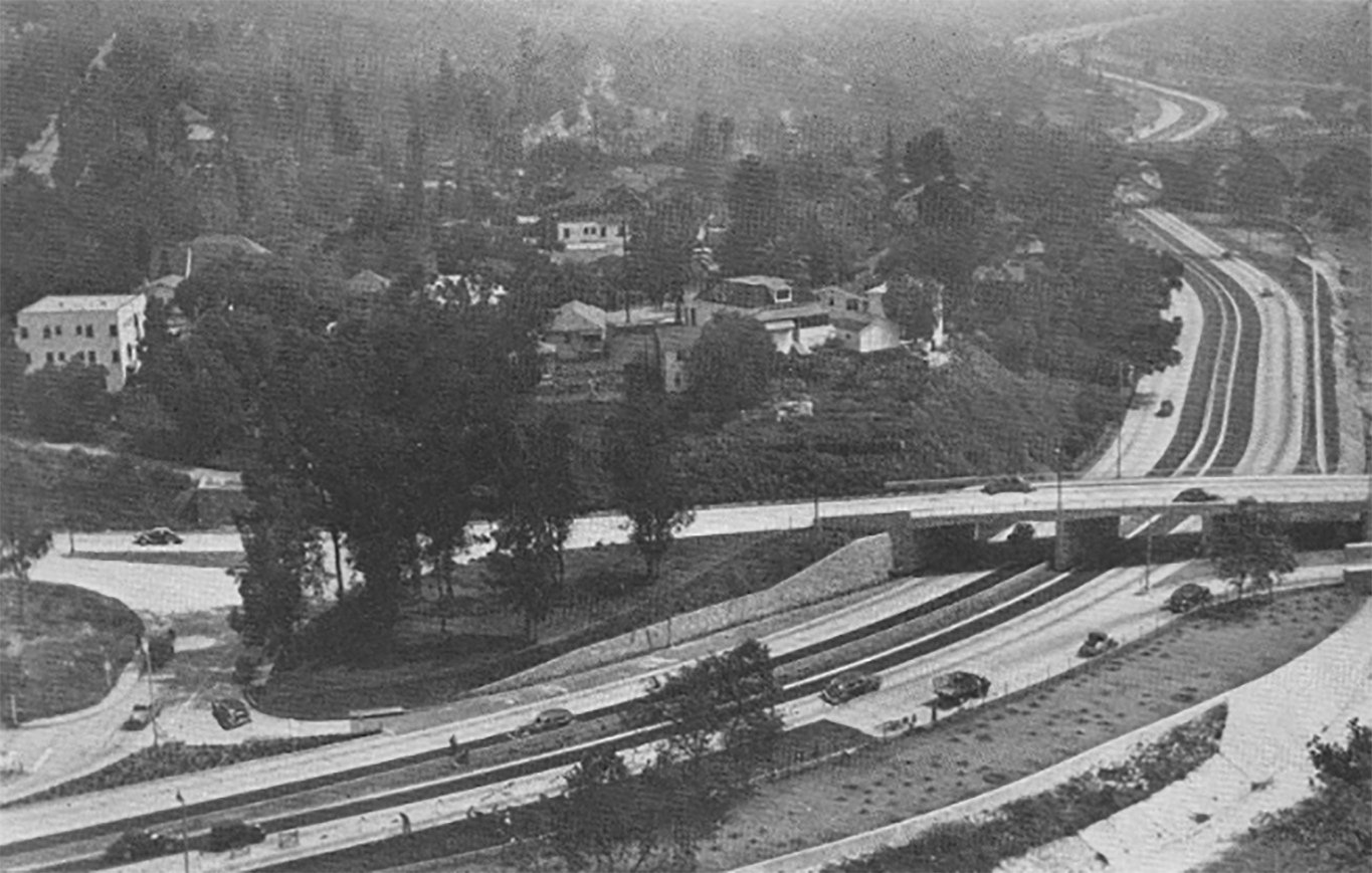
Metro-Equity-Toolkit-Arroyo-Seco-Parkway

For more information about LA’s transportation development in the 1930s click the button below.
1940s

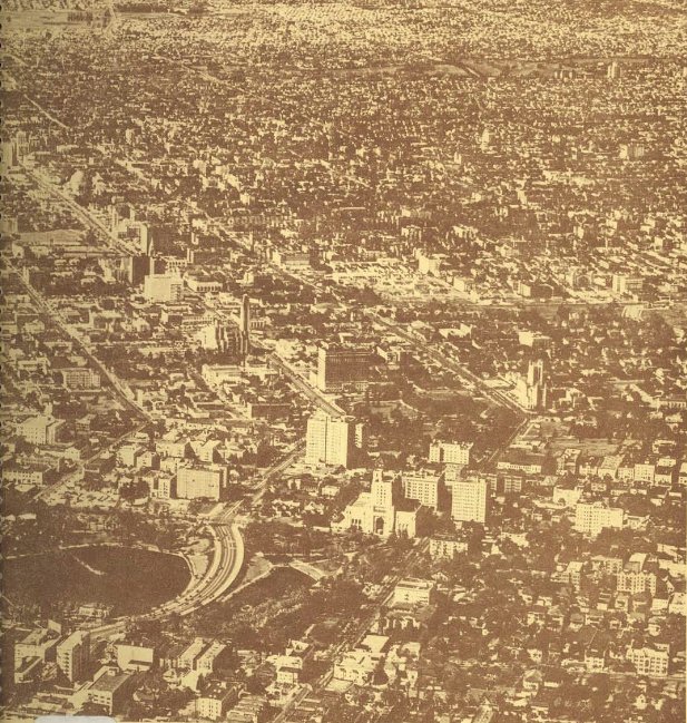
Freeway development across LA County begins ramping up. Existing public transportation services like PE continue to decline, despite efforts to implement rail rapid transit. Although public transit services saw an uptick in ridership during WWII, long travel and wait times, deferred maintenance and escalating automobile ownership contributed to a decline in PE rail. At the same time, redlining and racially restrictive covenants continue to define communities across LA. One of the only areas not covered in these restrictive covenants extended south from Downtown Los Angeles along Central Avenue to Slauson Avenue. 

1940
Highway Master Plan adopted

The Los Angeles Regional Planning District adopts “The Master Plan of Highways” with the endorsement of a State appointed Regional Commission. The County of Los Angeles adopted its own “Master Plan of Highways for the County of Los Angeles” on the same day. At this point, regional freeway planning had been explored within the context of existing mass transit and freeways were expected to be an integral part of LA County’s transportation landscape.

The Master Plan of Land Use is adopted in 1940. 

Spotlight

The Origin of “South Central LA”

Approximately 70 percent of LA’s Black population lived within the Central Avenue corridor and relied upon the Avenue to meet community needs. Because this stretch was along the southern section of Central Avenue, the term "South Central Los Angeles” gradually entered local vernacular.

1941
LA County publishes its highway master plan
Metro_EJToolkit_Historical-Context_Freeway-Plan-1941

LA County’s Board of Supervisors publishes their "Report on the Master Plan of Highways for the Los Angeles County Regional Planning District.” This report put forth 11 recommendations for highway construction and regional mobility, including that each incorporated city within the Region adopt a Master Plan of Highways.
President Roosevelt creates the Fair Employment Practices Committee (FEPC) by signing Executive Order 8802

Companies with government contracts were then required not to discriminate on the basis of race or religion.

1941-42
PE continues to reduce service lines after operating at a loss for several months
1942
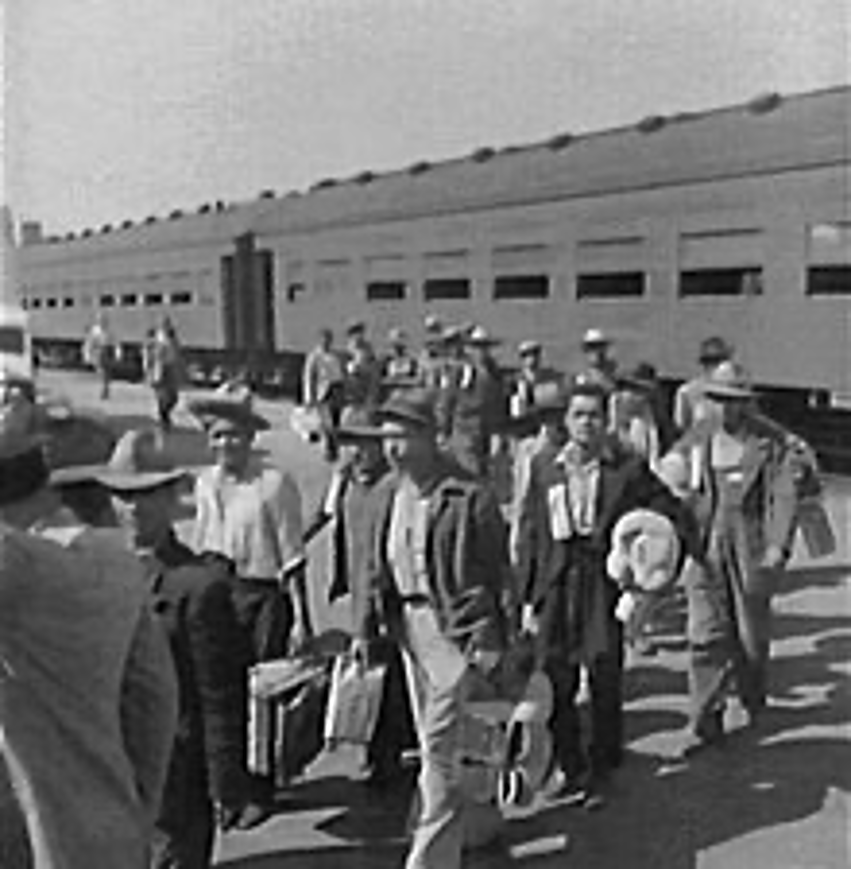
Metro_EJToolkit_Historical-Context_Bracero-Program

Congress establishes the Bracero Program bringing Mexican farm and railroad workers into the U.S. Southern Pacific Railroad requested permission from the government to allow Mexican workers to fill labor shortages during WWII. Railroad workers were subject to low wages, harsh or inadequate living conditions, food scarcity and racial discrimination.
LARy begins hiring women as streetcar and bus operators on a trial basis

This trial was successful. Over 300 women were hired by LARy as Motormen, Conductors and Coach Operators to replace men drafted during World War II.

1943

LA County’s regional planning commission published this foundational report, and the County adopted it as part of its highway master plan. For more information about this plan and other foundational transportation planning documents, visit the Metro Transportation Research Library and Archives by clicking the button below.

LARy commits to providing African Americans motorman job opportunities
1944
Arcola Philpott becomes LARy’s first black “motormanette”

Within a few weeks of hiring Mrs. Philpott, LARy hired its first Black motormen.

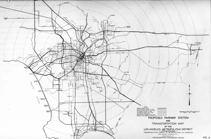
Metro_EJToolkit_Historical-Context_Transit-Study-1944

The Transit Study for the LA Metropolitan Area asserted that parkways (i.e. freeways) are vital to continued streetcar service in LA, and that passengers could arrive faster via motor vehicles as opposed to rail. It highlighted the need for cross-town transit service in Los Angeles County.

The study notes that “various rail lines have been abandoned—more probably will be. Some rights-of-way should continue to be used for transportation purposes.” This takeaway indicates a continuing decline in rail investment and use.
The Huntington Estate sells LARy to National City Lines

National City Lines renamed the rail system “Los Angeles Transit Lines” and began dismantling the streetcar system. General Motors, Standard Oil of California and Firestone Tire were among the company’s shareholders.

During the 1940s, about one million Angelenos lived within a half mile of Yellow Car/Los Angeles Transit Line streetcar lines.

Spotlight

The Great Transportation Conspiracy

The Great Transportation Conspiracy refers to the convictions of General Motors and related companies involved in monopolizing bus and supplies sales to National City Lines (NCL) and subsidiaries, as well as to the allegations that the defendants conspired to own or control transit systems. 

Between 1938 and 1950, NCL and its subsidiaries gained control of transit systems across the US, including LA, Oakland, St. Louis and Baltimore, often converting rail to bus operations.

Most of the companies involved were convicted in 1949 of conspiracy to monopolize bus, fuel and supplies sales to NCL subsidiaries, but were acquitted of conspiring to monopolize the transit industry. This suit created lingering suspicions that the defendants had plotted to dismantle rail to monopolize surface transportation.

This conspiracy has been featured in popular media, including Who Framed Roger Rabbit.

1946
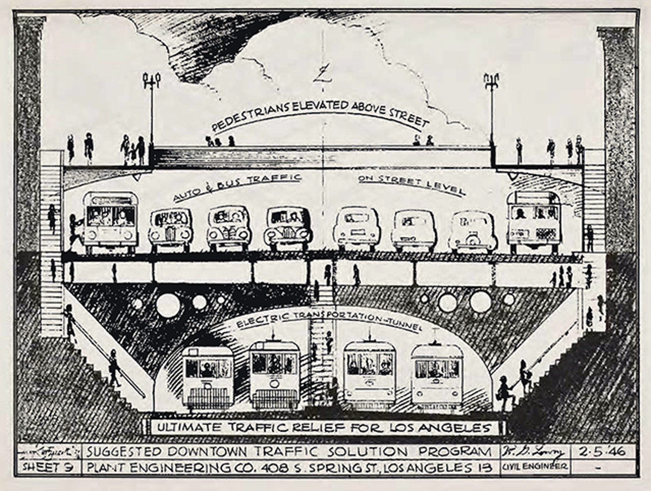
Metro_EJToolkit_Historical-Context_Plant-Program-1946

Traffic relief solution program proposed by the Plant Engineering Company in the Interregional, Regional Metropolitan Parkways in the Los Angeles Metropolitan Area Plan

The Plant Engineering Company wrote the report and advocated for a vast network of parkways. This plan acknowledged that existing streets were not designed to meet current traffic levels and suggested “the trend of transit is toward increased use of buses and commercial use of trucks.” The solution suggested by the report was to remove all Downtown LA sidewalks and elevate pedestrians above the street.
1947

based on early trails and roads, as well as existing PE routes which cars ultimately rendered obsolete.

Voter-approved gas taxes introduced
Collier-Burns Act passed

The act provided $76 million annually for new highway construction. Gas and diesel taxes, as well as driver license and registration fees, were increased.

1948

The ruling found that racially restrictive housing covenants could not legally be enforced.

1950s

Politicians agreed to construct a web of freeways across the region. This was seen as a better solution than a new mass transit system or PE upgrade. Construction of the interstate highway system begins.

1951
Large scale land acquisition begins

PE management further abandoned service lines in favor of converting to buses.

California State Legislature establishes the Los Angeles Metropolitan Transit Authority (LAMTA)

In establishing LAMTA, the Legislature’s goal was to study the possibility of establishing a publicly owned monorail line.

1952
Spotlight

The Harbor Freeway

The I-110 Harbor Freeway connects the Port of Los Angeles to Downtown Los Angeles. It runs through the heart of South Central and its construction displaced predominantly Black and Latino communities. I-110’s development and the adjacent regrading of Bunker Hill isolated LA’s new financial core from poorer, immigrant neighborhoods that surrounded it. Those living near the freeway today still face increased air and noise pollution and subsequent related health issues.

For more information on I-110’s development, subsequent “urban renewal” projects and spatial apartheid, we recommend the LA Times and Segregation by Design.

1954
LAMTA’s charge expanded to authorize the study and proposal of a more extensive regional mass-transit system
1956
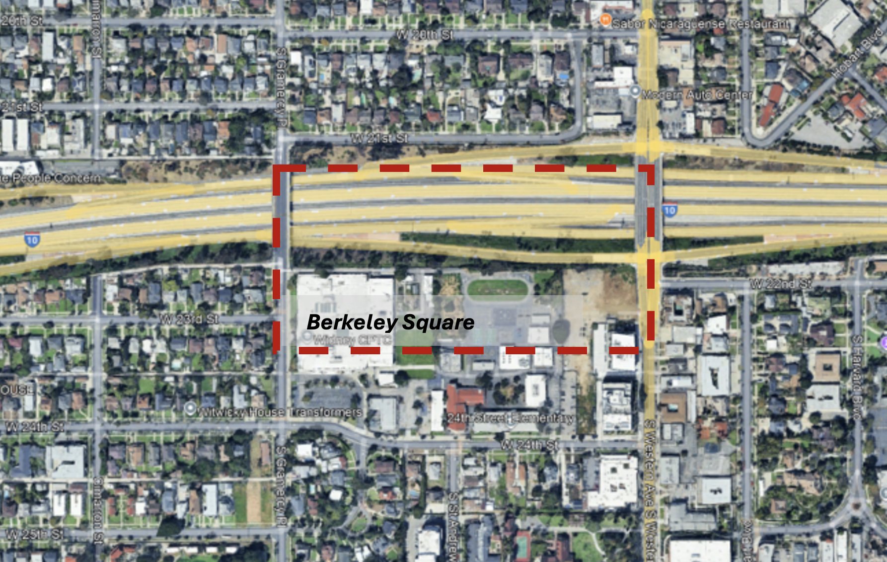
Metro_EJToolkit_Historical-Context_Berkeley-Square

Satellite image of section of 1-10 overlaid with the outline of former Berkeley Square neighborhood

This gave the HOLC and city planners a tool to route freeways through low-income communities of color, often using eminent domain to seize land and displace residents. Officials targeted previously redlined neighborhoods like Boyle Heights, justifying these projects as “slum clearance” and “urban renewal,” arguing that such routes would also serve to eliminate these communities.
California State Highway Commission campaigns to build both the I-110 and I-10 through the heart of South Central
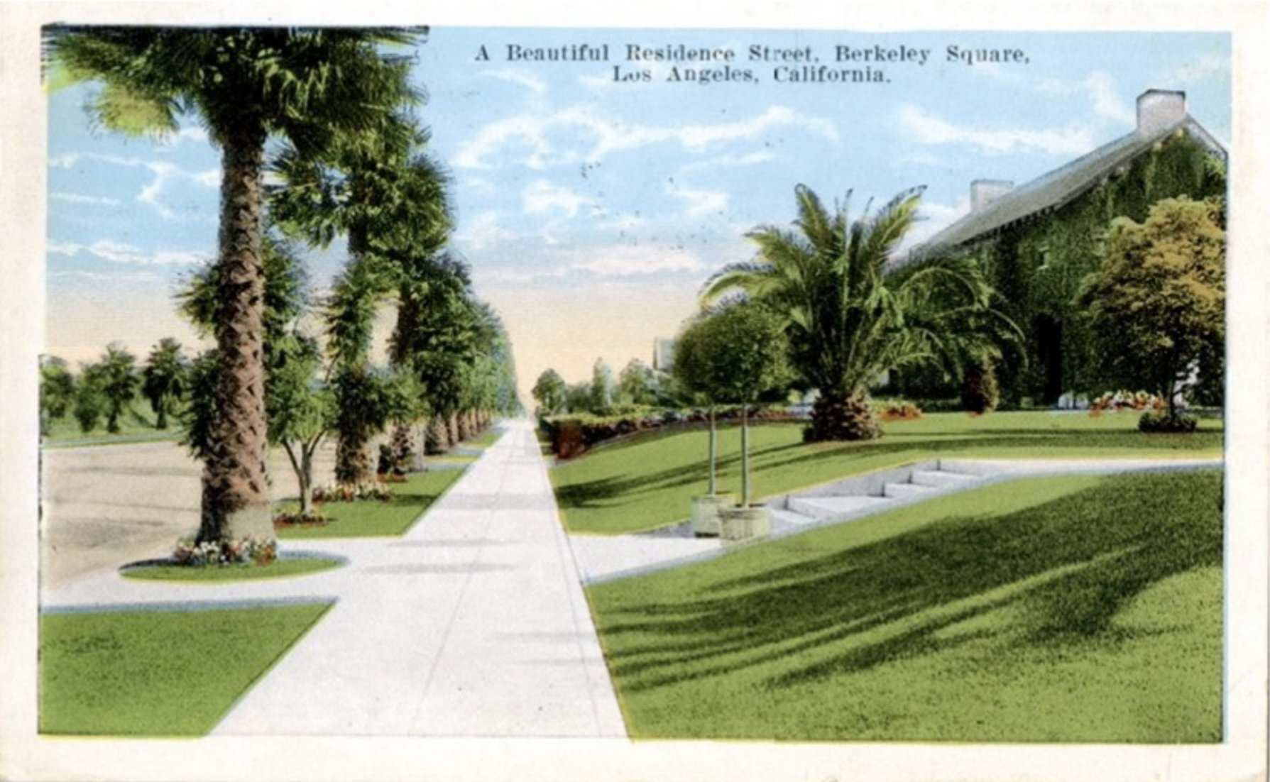
Spotlight
Metro_EJToolkit_Historical-Context_Berkeley-Square-Postcard
1958
LAMTA acquires Los Angeles Transit Lines and Metropolitan Coach Lines, PE’s successor
Metro_EJToolkit_Historical-Context_LAMTA-1958
1959
Jesse Unruh authors the California Civil Rights Act
Between 1943 and 1960
Five freeways constructed in and around Boyle Heights

Boyle Heights is a redlined neighborhood in East LA: I-5, US 101, SR 60, I-10 and SR-710. The first to be constructed, I-10, cut directly through Brooklyn Avenue, cleaving the neighborhood in two and displacing approximately 15,000 people.

Boyle Heights was redlined because of its diversity. A HOLC report called it an “ideal location for a slum clearance project.” For more information about Boyle Heights’ history, current gentrification issues and the highway system, visit KCRW and PBS.

1960s

Freeway infrastructure continues to expand across LA County at the expense of formerly redlined communities. Rail service continues to decline.

1961
East LA Interchange begins construction in Boyle Heights

The Interchange becomes a crucial transportation corridor.

All remaining PE passenger lines close and are replaced with buses.

Spotlight

East LA Interchange

The East LA Interchange connects the I-5, I-10, SR 60 and US 101 freeways. This project disrupts East LA, West Commerce and Boyle Heights communities with cascading and compounding environmental and public health effects. It further devalued and isolated the area; Heins Heckroth, a lead engineer in the East LA interchange design, noted their “cost-effective” approach—selecting locations to build from a right-of-way cost standpoint which allowed planners to route through previously redlined communities where real estate had been devalued. Over 20,000 people were displaced to build the interchange, both in the proposed rights-of-way and due to ancillary effects on quality of life in surrounding areas. With the construction of major freeways, Boyle Heights and other adjacent neighborhoods experienced increased noise and air pollution, harming respiratory and cardiovascular health.

1962
President Kennedy issues Executive Order 11063—Equal Opportunity in Housing

Executive Order 11063 prohibited racial discrimination in all housing that received federal aid.

1963
LARy shuts down

The final five streetcar routes are converted to bus routes, ending an era of more than 65 years of electric railway transportation within the city.

Rumford Act passes

The Rumford Act prohibited racial discrimination by banks, real estate brokers and mortgage companies.

1964
I-710 becomes a designated State Route
Spotlight

SR – I-710 and Metro: Multimodal Mobility Improvement

Metro is actively partnering with vital Long Beach-East LA Corridor (LB-ELA Corridor) community and regional stakeholders to develop an investment plan that builds transportation projects and programs that prioritize safe, equitable and high-quality multimodal transit. These improvements will foster cleaner air, healthy and sustainable communities and economic empowerment for communities along the corridor.

A key component of this project is improving mobility and reducing congestion between Alhambra and Pasadena in part caused by the SR 710 gap. The plan aims to reduce bottlenecks and ease traffic flow locally with coordinated traffic signal timing, ramp metering, enhanced bus service and street and intersection improvements.

Metro is committed to investing in communities impacted by freeway facilities and implementing its vision for better multimodal transportation across LA County. By prioritizing the quality of life of local communities—specifically low-income communities and communities of color—Metro aims to refocus its highway management holistically, with a community-centered mobility approach for people and goods within highway corridors like SR 710.

The Southern California Rapid Transit District (SCRTD) is formed

SCRTD begins planning the Metro subway system. SCRTD was LAMTA’s successor—then California State Senator Thomas M. Rees (D-Beverly Hills) noted how SCRTD was meant to correct some LAMTA’s deficiencies. SCRTD took over 11 other failing bus companies across the region as well, including all the bus service operated by MTA.

1965
The Watts Uprising occurs
Metro_EJToolkit_Historical-Context_Watts-Uprising.
Spotlight

The Watts Uprising

The Watts Uprising was series of confrontations between the Los Angeles police and residents over a six-day period beginning August 11, 1965. These confrontations occurred in the Watts neighborhood and surrounding area—predominantly Black neighborhoods—and were motivated by anger at the Los Angeles Police Department’s racist and abusive practices, as well as continued frustrations over employment discrimination, racially restrictive covenants and poverty in LA. 

The McCone Commission, headed by former CIA director John A. McCone under then Governor Pat Brown, subsequently investigated the Uprising. The commission report identified the root causes to be high unemployment, poor schools and related inferior living conditions endured by African Americans in Watts. The report identified recommendations for addressing these problems, including: 

  • Emergency literacy and preschool programs
  • Improved police-community ties
  • Increased low-income housing
  • Job-training projects
  • Upgraded health-care services
  • More efficient public transportation

Most of these recommendations were not implemented.

The report explicitly highlighted housing discrimination, as well as disparate access to public transportation due to gaps left by LARy’s closure, as limiting access to economic opportunities, school and quality of life fulfillment in Watts. Specifically, the area’s lack of adequate east-west or north-south transit service created a sense of isolation.

1967

The Blue and White Bus Company was an African American-owned company based in Watts that serviced South LA. Dr. Thomas William Matthew of the National Economic Growth and Reconstruction Organization (NEGRO) acquired two South Los Angeles bus companies: Atkinson Transportation Company (ATCO) and the South Los Angeles Transportation Company.

1968
President Lyndon B. Johnson signs the Civil Rights Act
Spotlight

Eminent Domain in the 1960s

In response to the 1965 Watts Uprising, the California State Legislature sought to widen and expand LA County’s highway system. The County seized residential neighborhoods through eminent domain, dividing communities and commercial corridors. These projects, including construction of both the Imperial and I-105 (Century Freeway), were initially delayed by civil litigation brought by affected community members.

1970 – 2000, Building the Metro of Today

LA County purchased the remaining rail rights-of-way from the Southern Pacific Transportation Company, laying the foundation for Metro’s current rail and bus rapid transit networks.

1970
Up to 30,000 demonstrators march through East LA as part of the National Chicano Moratorium Against the Vietnam War

This coalition was one of the largest Mexican American anti-war demonstrations and expressed the community’s lament over the disproportionate number of Mexican American troops drafted during the Vietnam War.  The march ended in violence after the arrival of the LA County Sheriff’s Department.

1971
The Blue and White Bus Company is taken over by SCRTD following years of financial and legal hardship
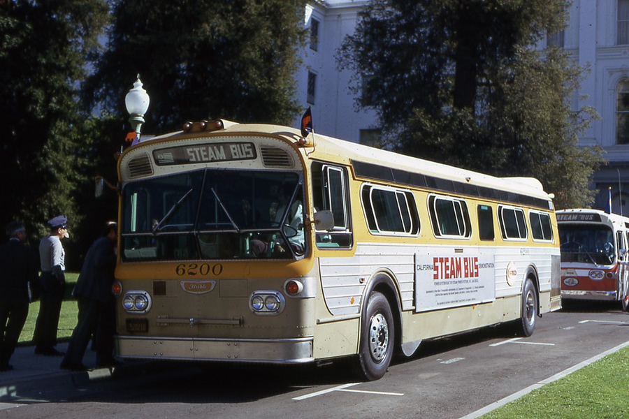
Metro_EJToolkit_Historical-Context_Steam-Bus
1973
El Monte Busway, the “world’s first bus rapid transit station,” opens

Today, the El Monte Busway, along with the Harbor Transitway, forms the Silver Line. It remains one of the most successful high-occupancy vehicle facilities in the United States, and it is the oldest high-occupancy vehicle (HOV) facility in the Los Angeles area.

1976
Los Angeles County Transportation Commission (LACTC) forms

LACTC forms from the requirement that all counties in the state form local transportation commissions. Its main objective was to guard all transportation funding, including both transit and highway funding, for Los Angeles County.

The LACTC develops plans for a light rail system
1980

Proposition A passes, generating transportation funding to address public transit challenges across LA County. The Proposition A language emphasized the use of funds for construction of the “rapid transit rail system” using existing rights of way.

1982
Extensive residential demolition occurs between Imperial Avenue and East 117th Street to expand the Imperial Highway after a civil litigation settlement between the County and community members
1985
SCRTD forms two Benefits Assessments Districts for the central business district and Wilshire Alvarado areas

These districts levied an additional property tax for a 20-year period on all commercial properties within a half mile radius of the Central Business District and within one-third mile radius of the Alvarado station as part of a value capture strategy for the Metro Rail Line (Red Line).

1989
LACTC establishes the Art for Rail Transit program

The program requires that half of 1% of rail construction costs must enhance the rail system through art.

1990
First artists selected to contribute to station designs as part of LACTC’s Art for Rail Transit Program
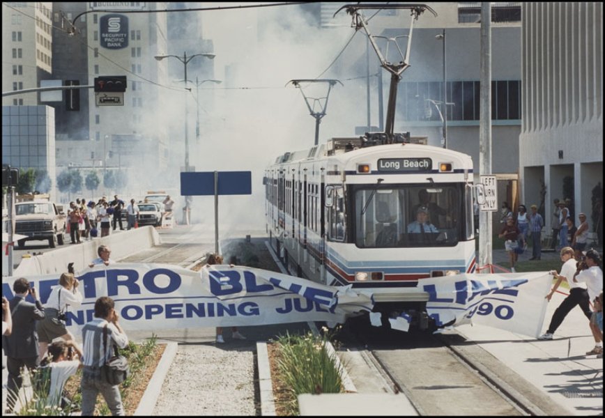
Metro_EJToolkit_Historical-Context_Blue-Line-Opens-1990

The line runs from downtown LA to Long Beach using the former PE roadbed, returning electric rail passenger service to the County. As the Metro rail system expanded, it retrofitted many of PE and LARy’s former rights-of-way.
Proposition C passes

The proposition generated additional funding to support public transportation projects and programs initiated through Prop A funding, including rail system expansion.

1992
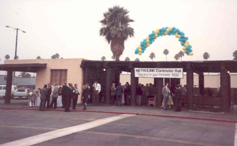
Metrolink begins operation
Metro_EJToolkit_Historical-Context_Metrolink-1992

Following the Southern California Regional Rail Authority (SCRRA)’s formation as a Joint Powers Authority (JPA), active and abandoned track in the region was purchased to create Metrolink. Metrolink serves as Southern California’s commuter rail agency and operates three routes as alternatives to freeways.
The Los Angeles Uprising erupts after the police offers who assaulted Rodney King are acquitted
1993
SCRTD and the LACTC merge

becoming the Los Angeles County Metropolitan Transportation Authority—LA Metro.

The first segment of Metro’s Red Line opens between Union Station and the 7th/Metro Station. This line is later renamed the B Line.

I-105, the Century Freeway, opens

I-105 replaced an abandoned PE route and separated residents of West Athens-Westmont from Los Angeles Southwest College, which was previously within walking distance. The Century Freeway was also in part constructed so that law enforcement could more easily access and deploy to urban centers (as recommended in the McCone Commission).

The project limited community educational facility access, and funding earmarked for community development was reallocated towards its construction. Five hundred units of planned replacement housing on acquired lots were never constructed, and Martin Luther King Jr. Community Hospital, a major healthcare center in Willowbrook, was downsized due to limited funding.

1995
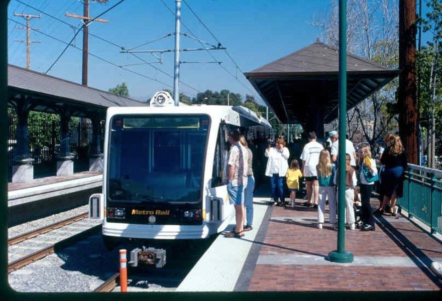
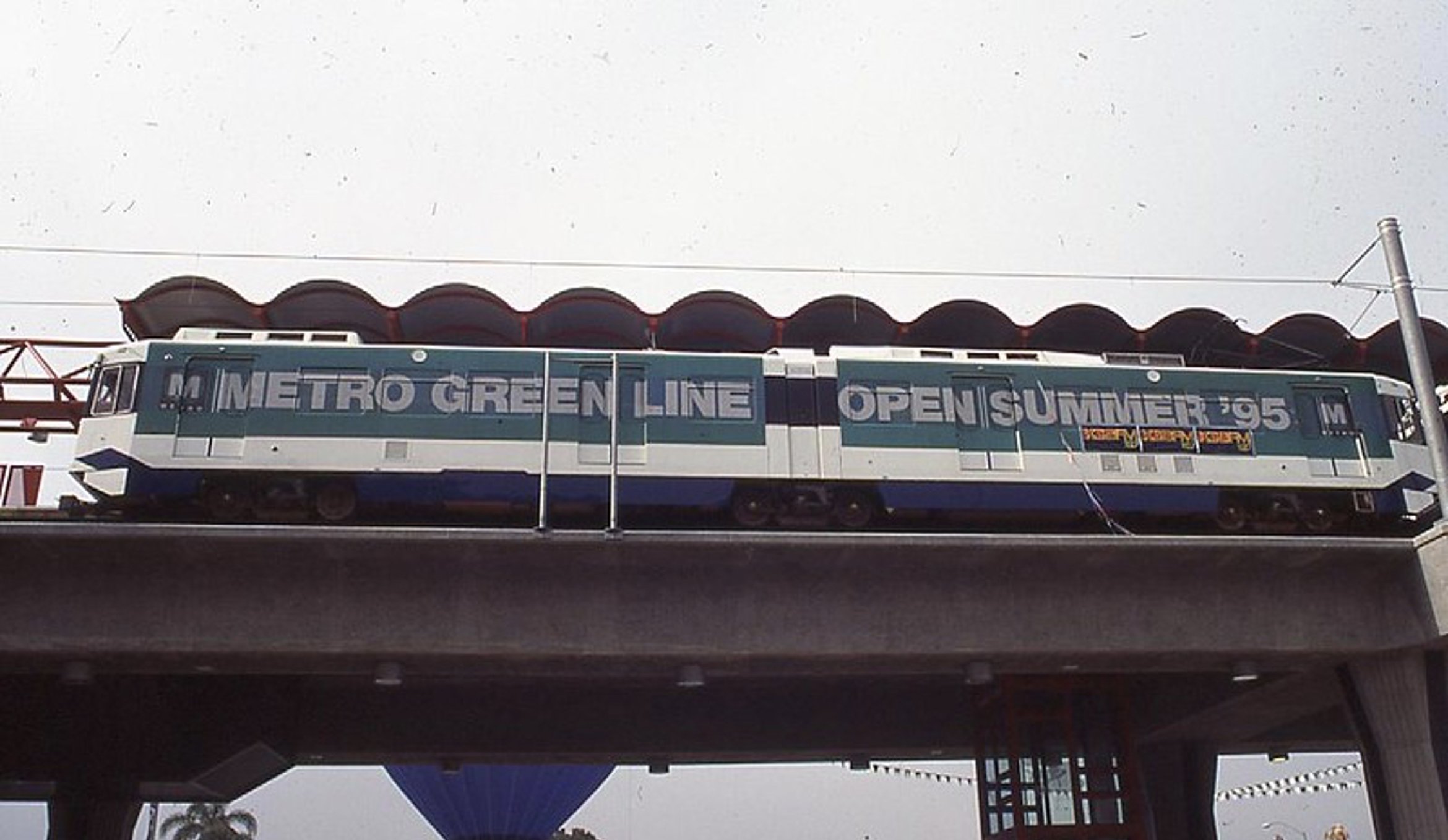
Metro Green Line begins operation
Metro_EJToolkit_Historical-Context_Green-Line-1995

Poster on Metro Rail saying "Metro Green Line Open Summer ‘95”
Spotlight

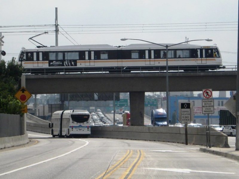
Metro’s Green Line

The C Line (formerly Green Line) is a light rail that operates between Westchester and Norwalk and runs primarily in I-105’s (Century Freeway) median. It is one of the six rail lines operated by Metro and has been in operation since 1995. It was built to improve LAX’s accessibility and ease pollution impacts for communities along the I-105—a heavily contested and controversial freeway. This line has faced a series of challenges since its inception.

Ongoing Green Line Challenges and Lessons Learned:

Despite these challenges, Green Line ridership has grown steadily over the years, and improvements continue to this day with the goal of making the C Line more effective for Angelenos.

1999
Metro Art—formerly known as Art for Rail Transit—celebrates 10 years

Between 1989 and 1999, the program commissioned 175 artists to create art for stations and other transit projects.

Modern Metro, 2000s-Today

2000
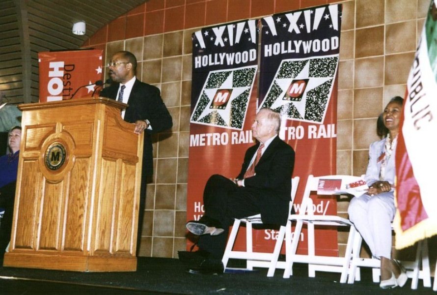
Metro Red Line (now B Line) extension to North Hollywood opens
Metro_EJToolkit_Historical-Context_Red-Line-Opening
2003
Metro Gold Line (formerly the L Line, now the E Line) opens
Metro_EJToolkit_Historical-Context_Gold-Line-2003

The service connected Union Station to East Pasadena.
2005
Metro Orange Line, later renamed the G Line, opens
2006
Trains traveling between Union Station and Wilshire/Western are rebranded as the Purple Line (later renamed the D Line)
Metro named America's Best Transit System by the American Public Transportation Association (APTA)
2009
Metro Silver Line, a bus rapid transit service now named the J Line, opens
Metro Gold Line Eastside Extension (now E Line) extends service between Union Station and East LA
Metro_EJToolkit_Historical-Context_Gold-Line-Extension
2010
Metro Gold Line (now A Line) extension breaks ground

The extension expanded service between Pasadena and Azusa. A further extension to Pomona and Montclair is currently underway.

2012
Metro’s Expo Line between downtown LA and Culver City (now E Line) opens
2014
The D Line extension toward Beverly Hills and Westwood breaks ground

Several phases have since been completed, with segments planned to open in stages through 2027.

Metro breaks ground on the Regional Connector Transit Project

The project reconfigured the A and E Lines with three new stations, providing a convenient one-seat ride into Downtown LA and reducing the need for transfers.

2015
LA releases its first ever Sustainable City Plan

establishing a roadmap for citywide green goals by 2017, 2025 and 2035, spanning topics including transportation, accessibility and neighborhood livability.

2016
LA Metro Bike Share program opens

with 1,000 bikes and 65 stations downtown.

Spotlight

Measure M is approved

This Measure funds projects that ease traffic, repair streets and sidewalks, expand public transportation, earthquake retrofit bridges and subsidize transit fares for students, seniors and people with disabilities. It partially funds Metro projects and makes funding available to local jurisdictions through:

  • Metro Subregional Program (MSP)
  • Metro Active Transportation, Transit and First/Last Mile (MAT) Program
  • Local Return
2018
Metro approves NextGen Bus Plan

to enhance bus speed, frequency, reliability, and accessibility across the County. The proposed improvements would:

  • Double the number of frequent Metro bus lines
  • Provide more than 80% of current bus riders with 10 minute or better frequency
  • Improve and expand midday, evening and weekend service, creating an all-day, 7-day-a-week service
  • Ensure a ¼-mile walk to a bus stop for 99% of current riders
  • Create a more comfortable and safer waiting environment
2019
Metro’s Office of Equity and Race established
2020
Metro’s board formalizes a reimagined approach to champion art

Through its motion titled “Uplift the Human Spirit Through Metro Art,” Metro recommits to championing local artists through arts programming and initiatives that enrich customer experience, advance cultural equity and respond to LA’s diverse and ever-evolving cultural landscape.

2022
Metro officially adopts Multimodal Highway Planning Principles

prioritizing a more integrated transportation planning approach that improves mobility via multimodal transit, reduces congestion and fosters more livable and sustainable communities.

The I-405 Comprehensive Multimodal Corridor Plan is adopted

This plan aims to understand the diverse needs of the communities that rely on and are impacted by the I-405 Corridor. It facilitates input and demonstrates how multimodal improvements can reduce congestion, increase accessibility and mobility for all users and advance equity for historically disadvantaged communities.

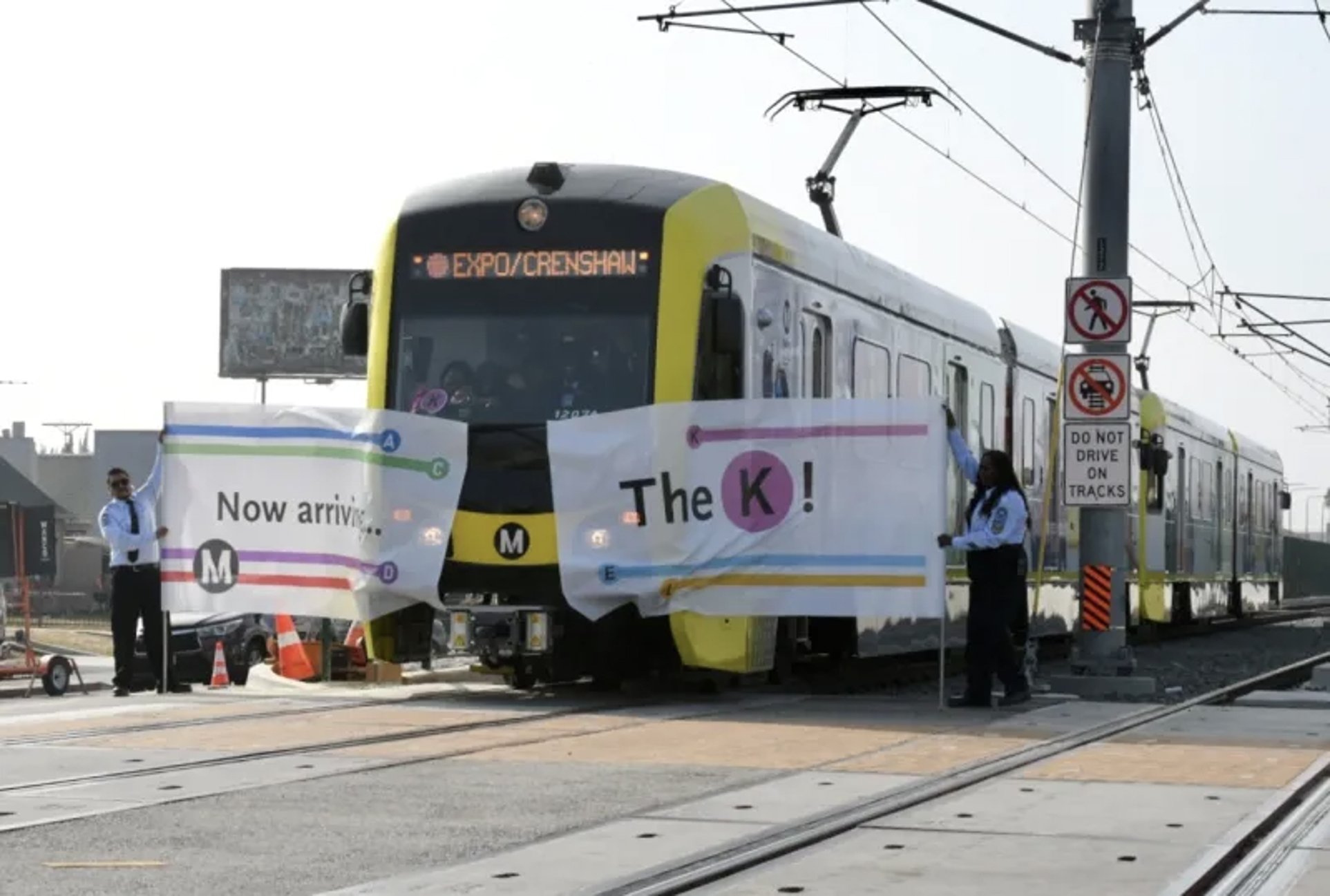
The Crenshaw K Line opens
Metro_EJToolkit_Historical-Context_K-Line-2022

Photo from the "K Line" Opening with a banner saying, "Now arriving...The K!"

2023
The Regional Connector opens, earning the A Line the distinction of "longest light rail line in the world"

The A Line features 44 stops and spans over 48.5 miles.

2024

In honor of civil rights leader Rosa Parks’ birthday, Metro offers free rides on its buses, trains, bike share and other public transportation services every February 4th.

Spotlight

Transit Equity Day

“Transit Equity Day is a reminder that transit agencies like Metro have a duty to embed equity into everything we do.”

- Stephanie Wiggins, LA Metro CEO

2025
Segment A of the Rail to Rail Active Transportation Corridor opens, connecting the K Line at Fairview Heights to Slauson Station on the A and J Lines

This walking and biking path enhances safety, access and connectivity for communities in Inglewood and South LA. Planning for Segment B, which extends the path to the LA River, is currently underway.

Spotlight

Transit Equity Day

“Transit Equity Day is a reminder that transit agencies like Metro have a duty to embed equity into everything we do.”

- Stephanie Wiggins, LA Metro CEO

Wildfires devastate Los Angeles

The Pacific Palisades Fire, Eaton Fire, and other smaller wildfires strike Los Angeles in January, claiming 30 lives and forcing 180,000 people to flee their homes. Metro temporarily suspends fare collection, expands eligibility for its reduced fare (LIFE) program and deploys outreach teams to support fire victims.

The LAX/Metro Transit Center opens

providing connections from the C and K lines directly to LAX airport.

Metro observed a 10-15% drop in ridership in some areas immediately following U.S. Immigration and Customs Enforcement (ICE) activity, reflecting fear and uncertainty experienced by Angelenos.

On February 12, 2025, Metro Board Chair Janice Hahn sent a letter to Metro CEO Stephanie Wiggins requesting that the agency partner with the Los Angeles County Office of Immigrant Affairs to place “Know Your Rights” information on Metro buses, trains and throughout the system. Under the leadership of CEO Wiggins, Metro also provided emergency response training to Metro Security, bus operators, transit ambassadors and other frontline employees regarding their rights and responsibilities to themselves and Metro’s riders.

To read Metro’s Board Report on Ensuring Safe and Reliable Metro Service for All Riders, click the button below.

SB-79, the Abundant and Affordable Homes Near Transit Act, passes

SB-79 made it legal to build more multi-family housing developments near rapid bus lines and rail stations, including in areas where such homes were previously illegal due to local zoning limitations.

See Works Cited for the Historical Context above.

Current Projects Under Construction

LA Metro is working hard to extend and improve our services. Looking forward, Metro has a collection of multimodal projects scheduled, including:

  • The D Line extension to connect Wilshire/Western to Beverly Hills and Westwood. Section 1 is scheduled to open in 2025, with sections 2 and 3 scheduled to open in 2026 and 2027, respectively. This project will include a diverse range of site-specific artworks commissioned through Metro Art.
  • The A Line Montclair extension, scheduled to open in 2030.
  • Segment B of the Rail or Rail Active Transportation Corridor, currently in planning phases.
  • The Long Beach-East LA Corridor Mobility Investment Plan, a community-driven effort to reimagine transportation and quality of life along the I-710 Corridor, currently in its planning phase. Adopted in April 2024, this Plan replaces an initial freeway widening proposal with a more equity-centered and community-driven vision for mobility, health and justice. For more information, click here.
  • The I-605: Valley Bl Improvements Project, which will improve safety and traffic flow along I-605 at Valley Blvd in the San Gabriel Valley, currently in the design and engineering phase.
  • The I-10 ExpressLanes Extension, which will improve travel on the I-10 with upgraded toll lane and carpool options, currently in the environmental review phase.


For more information about projects under construction, click here.

For more information about Metro’s transportation history, click here.

Lasting Impacts

Metro understands the lasting impacts caused by transportation projects as well as the importance of addressing these impacts now and into the future. Incorporating equity in our infrastructure and planning is a key component of our goal to provide access to opportunity for all Angelenos. By understanding how we got here, we can take the first step in integrating equity into project development and programming. Our history not only informs our current position as an organization but also lays the groundwork for a better path forward. For more information about the lasting impacts of transportation projects in Los Angeles, click the button below.